Welcome note

When my husband and I set out to find and take pictures of wheelchair accessible waterfalls in every U.S. state, we were excited about the challenge. We gave ourselves no time limit to accomplish our feat; however, we had one mutually agreed upon rule that dictated how long we would stay in any given area. That rule was to never shiver again. Needless to say, adhering to this rule presented a new challenge. The new challenge was to find a waterfall that was actually flowing. Visiting mid-west and eastern states during months that prevented us from shivering are the same months that are hot enough to dry up streams; hence, little or no water flow for waterfalls. The natural scenery and picturesque landscapes warrant a second visit in the early spring right after the snow melts.

Bob and Jan

Bob and Jan
Christmas Eve

Total Pageviews

Sunday, June 29, 2014

WHITEHORSE FALLS, OREGON

Whitehorse Falls is a Punchbowl Fall located at milepost 65.9 on Highway 138. A gorgeous sturdy decking leads to an overlook. Wheelchair access is easy. The 15-foot falls is located on the Clearwater River in the Umpqua National Forest.

Waterfall Type:  Punchbowl - descends from a constricted width of a stream, empties into a pool below.

Directions:  Turn north at Whitehorse Falls Campground entrance on Hwy 138 at milepost 65.9.


SUSAN CREEK FALLS, OREGON

Susan Creek Falls can be found on North Umpqua River in Umpqua National Forest in Douglas County, Oregon. The waterfall is a Fan type fall that drops 50 feet over moss-covered rocks.  The falls can be accessed by an easy path that is well-maintained by the Bureau of Land Management. The 3/4 mile trail to the waterfall is evenly graded and is accessible by wheelchair; however, manual help may be needed for endurance to make the distance.

Directions: The trailhead is directly off of the parking lot located at milepost 28.2 on Highway 138. A Susan Creek Day-Use Area is across the highway. Picnic tables and restrooms are available at the day-use area, trailhead, and below the waterfalls.

Waterfall Type: Fan - descends vertically while maintaining some contact with the rock surface with an increasing width of spray.


Wednesday, June 11, 2014

McARTHUR-BURNEY FALLS STATE PARK - Burney, California

Over a million years ago, volcanic activity created Burney Falls and its landscape. 100 million gallons of water flow through Burney Falls everyday.

The 129-foot Burney Falls was named after Samuel Burney. McArthurs settled in the area in the late 1800s. Then descendants of the McArthur's saved the waterfalls and area from development and donated it to California state in 1920.

Address: McArthur-Burney Falls Memorial State Park, 24898 State Highway89, Burney, CA 96013 * (530) 335-2777

The upper falls overlook is directly off of the parking area. A short paved path leads to a stone wall that overlooks the massive waterfall.  There are two options to get to the bottom of the waterfall.  Option one is to take a paved curvy path that consists of steps and smooth walkways.  Option two is a 1.2 round trip smooth dirt hiking path that starts at Lake Britton.  It follows the lake and stream that leads from the falls. A wheelchair, stroller, or challenged walker can easily take this path to the lower falls.


Thursday, June 5, 2014

MCCLOUD RIVER FALLS - McCloud, California

Indian tribes came to McCloud River Falls to fish for Rainbow Trout, hunt Elk, eat acorns, pine nuts, wild onions, wild plums, mushrooms, elderberries, make baskets from Native plant materials, and use plants for medicine, tools, clothes, and temporary houses

ACCESSIBILITY: McCloud River Falls 
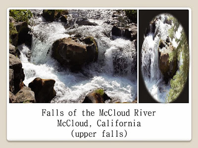
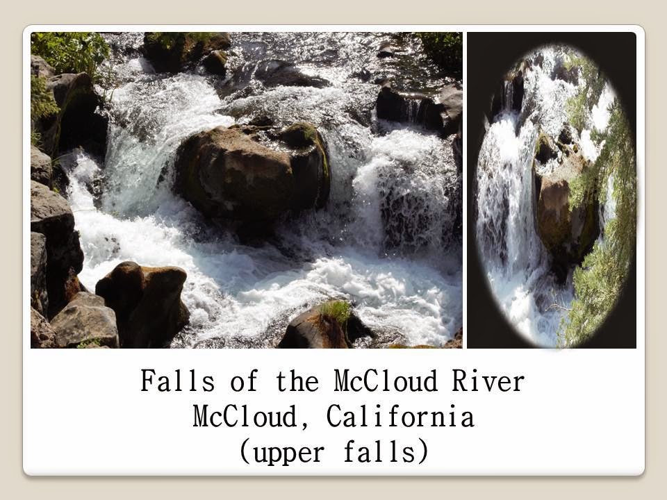
consists of three impressive waterfalls: Upper, Middle, and Lower Falls. The Upper and Lower Falls are easily accessible by a paved walking path directly off of the parking area. The Lower Falls are within an earshot of the parking area. The Middle Falls are hard to find and are found along a rough trail. The overlook for the Upper Falls is only a few steps from the parking lot - just past the bathrooms and picnic area.


DIRECTIONS: Use Highway 89 for 15 miles east of the I-5/89 junction and 5 miles east of McCloud and turn south on Road 40N44. (Look for a Fowlers Camp/McCloud Falls sign.) Go right at .6 mile (a left here takes you to overlooks of Middle Falls and Upper Falls) Continue another .7 mile past the campground and park at the picnic area at the Lower Falls. Follow your ears toward Lower Falls and the beginning of the trail.

Roads are not plowed during winter. For road and waterfall accessibility, call McCloud Ranger Station, Shasta-Trinity National Forest, P.O. Box 1620, McCloud, CA 96057; (530) 964-2184.